
Point of Beginning – Where It All Began
Photos courtesy Andy Chandler
Mention western expansion, and that normally conjures images of canvased wagons lumbering across the prairie or images of fur trappers in the Rockies.
Few stop to think about one simple question: how were they going to survey and parcel that land? Property boundaries and land claims are still a big deal today, and there’s a reason why all four of the men on Mount Rushmore were trained surveyors.
Before American Independence, most of the boundaries were made by someone thousands of miles away pointing to latitude on a map and saying ,”there.” In fact, the original 17th century maps had Virginia’s boundaries extending to the Mississippi River. After Independence, the United States under the Articles of Confederation, came across a land windfall when they were given the Northwest Territory in the 1783 Treaty of Paris. This doubled the size of the United States. With financial debts from the Revolutionary War, and a population just itching to expand west, the slogan of expansion wasn’t ,“go west young man,” as it was, “sell, baby, sell.”
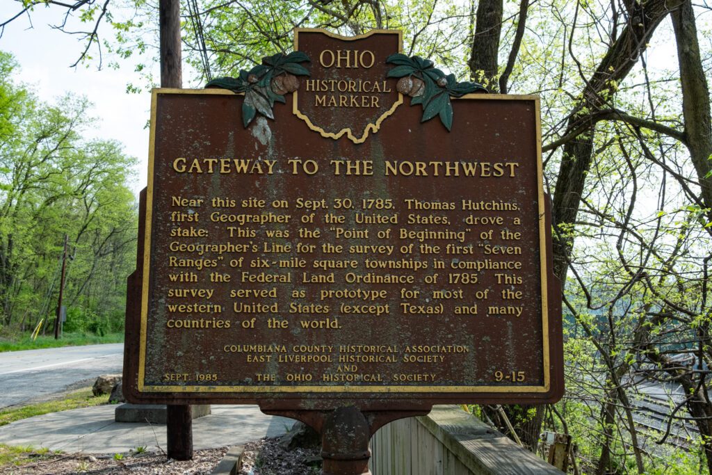
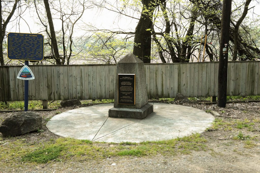
The Land Ordinance of 1785 was passed on May 20th, 1785. Revolutionary War Veteran Thomas Hutchins was assigned as the country’s first surveyor. Later that year on October 11th, Hutchinson hammered a stake on the western shore of the Ohio River at a point where Virginia (now West Virginia), Pennsylvania and the Northwest Territory all met. This began the Public Land Survey System (PLSS).
Often the most significant things are presented in the most insignificant packages. Several years ago, my wife and I found ourselves in the greater Pittsburgh area for a friend’s wedding. I suggested we go see the marker. It can easily be mistaken for a mileage marker or a “welcome to Ohio” sign. It’s as tall as me. The original stake has now eroded into the middle of the Ohio River. The marker that it represents was placed in 1881. It sits on the west side of the river at the point where Pennsylvania and Ohio meet. Someone visiting can see where the roads change as each state’s point of maintenance merges in front of the marker.
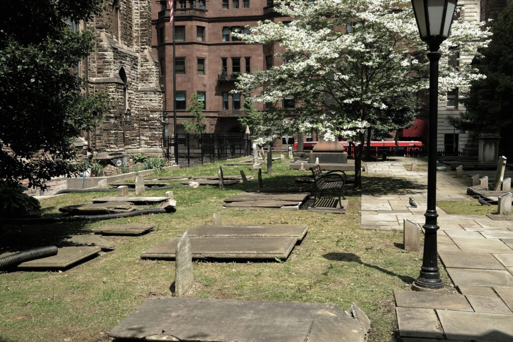
Unfortunately, Hutchins didn’t live much longer and he died in 1789. He’s buried in an unmarked grave in First Presbyterian Church graveyard in downtown Pittsburgh, PA. I took a moment to head over there. Walking along the stones, I smiled. If only Thomas Hutchinson could see what he started.